
Google Maps' feature that uses AI to predict when walking or taking transit will get you to your destination in roughly the same amount of time as driving is headed to Copenhagen, Stockholm, and Warsaw.
In cities like Hamburg, Madrid, Barcelona, Milan, Rome, Zurich, Budapest, Vienna, and Brussels, you will be able to see where you have dedicated cycling lanes, along with details like heavy car traffic or steep hills.
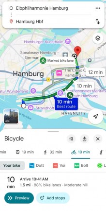
Google Maps' new features for Europe
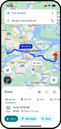
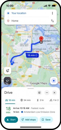
There's also a new option to use fuel-efficient routing for driving, which is live globally, and you can see when you'll be traveling in over 1,000 low-emission and low-traffic zones across Europe "in the coming months". The feature will let you check if your vehicle is allowed in these zones, and choose an alternate route if needed.
Finally, Google is expanding its ability to use AI and Maps driving trends to model traffic patterns and recommend how cities can optimize their traffic light plans, with Vilnius in Lithuania being the latest city to benefit.


 English (US)