
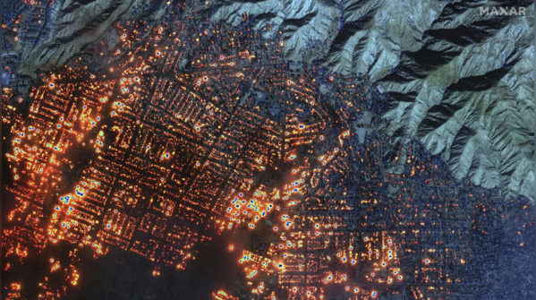
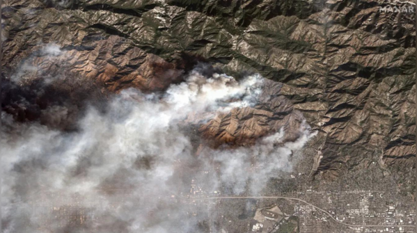
1/7
Satellite images released
Satellite images of Los Angeles, showing the effects of California wildfires, were recently released by various agencies. The images reveal large areas of burned land and devastation in the region. (Photo: AP)
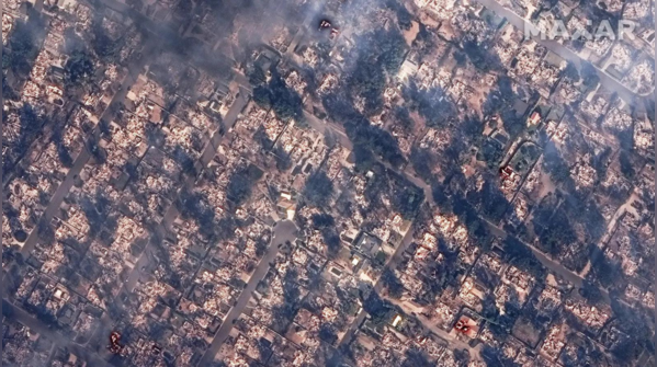
2/7
Destroyed houses
This satellite image shows burning and destroyed houses from the Eaton Fire near Marathon Road, in Altadena, California. (Photo: AP)
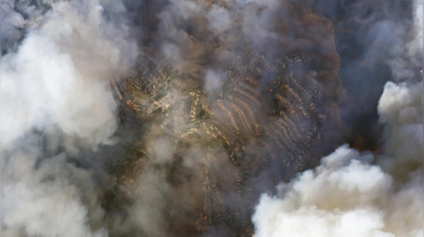
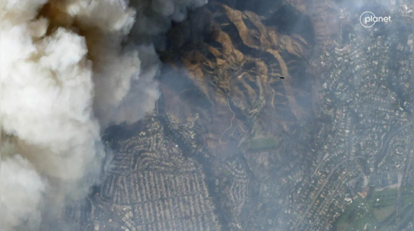
3/7
Smoke of Palisades fire
This satellite image, taken by Planet Labs PBC, shows smoke from Palisades fire over Los Angeles, California, on January 8. (Photo: AP)
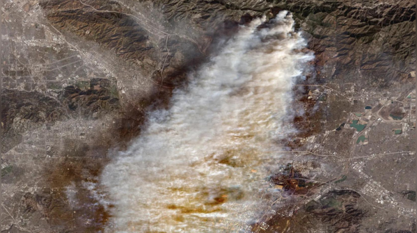
4/7
Overview of Eaton fire burning
This satellite image shows an overview of the Eaton fire burning in Los Angeles. (Photo: AP)
5/7
Eaton fire, an ongoing wildfire in Altadena
The Eaton fire is an ongoing wildfire in the Altadena area of Los Angeles County, Southern California. It started on the evening of January 7, 2025, in Eaton Canyon, located in the San Gabriel Mountains. (Photo: AP)
6/7
'Looks like an atomic bomb dropped'
Los Angeles county sheriff Robert Luna said during a press conference that it "looks like an atomic bomb dropped in these areas," referring to the wildfire. (Photo: AP)
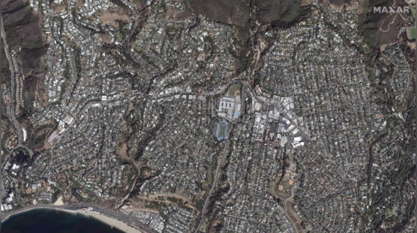
7/7
Overview of homes before fire
This satellite image shows an overview of homes before the Palisades fire in the Pacific Palisades neighborhood of Los Angeles. (Photo: AP)
FOLLOW US ON SOCIAL MEDIA


 English (US)